Maggie - Whale Shark Tracking with SPOT Tags off the Yucatan Peninsula, Mexico
A project of Proyecto Domino.
Static Map | Zoom Map |
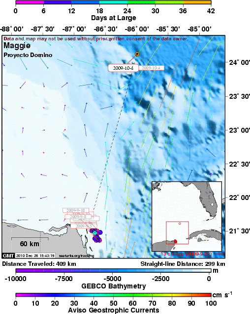
Track of female whale shark (Maggie) that was tagged with a SPOT5 satellite tag.
 |
 |


|
|---|
| MTN | ISTS | Directory | Groups | Bookstore | Resources |
|---|
|
Satellite TrackingMaggie - Whale Shark Tracking with SPOT Tags off the Yucatan Peninsula, Mexico A project of Proyecto Domino. Static Map | Zoom Map | Track of female whale shark (Maggie) that was tagged with a SPOT5 satellite tag.
Background Maggie is a female whale shark with an estimated total length of 8 m. She was tagged with a SPOT5 tag that was attached to her first dorsal fin with a rare earth magnet apparatus (an experimental design). Hence the given name of Maggie. 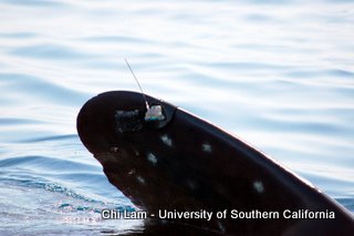 Surface view of Maggie's SPOT tag mounted to her 1st dorsal fin. Maggie's SPOT tag transmitted nicely for the first couple days and let us know that she remained in the general area where we tagged her. After a few more days the transmissions received from Maggie's tag became less regular leading us to believe that there may have been a problem with her tag or its attachment. We know that she remained in that same area off Isla Mujeres until at least September 18th. One final signal was received from her on October 4 at a position north-northeast of the Yucatan Peninsula, about 300 km from her tagging site. 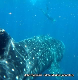 A view of Maggie as Nick Whitney of Mote Marine Lab dives to photograph her. However, Maggie's story does not end there. She was also tagged with a pop-up archival transmitting tag (PAT). This type of tag archives depth, light, and temperature data and then transmits this information in summary form after the tag detaches from the shark and floats to the surface on a pre-determined date. Fortunately for us, the PAT tag did pop-up and began transmitting its stored data on December 6th, 2009. Subsequent analyses revealed that Maggie dove down to at least 1,392 m on a journey that took her into the Straits of Florida to Cubaâs north-central coast before migrating back west and having her PAT pop-up at a position northwest of Cuba, about 272 km from her tagging site.
SEATURTLE.ORG collaborates with Argos to help scientists and conservationists manage and analyse their valuable animal tracking data. 
|
| About seaturtle.org | FAQ | Privacy Policy | Terms of Service |
|---|
|
Copyright © seaturtle.org All rights reserved. If you have questions or comments about seaturtle.org please contact support@seaturtle.org. If you have questions or comments about the website please contact the webmaster. |