Aerial Surveys
Every season, we carry out three aerial surveys of the entire Gabonese coastline just before, during and after peak nesting, about one flight per month. With the aerial surveys we can get an overall idea of how many sea turtles are nesting in Gabon and where they nest (some coastal areas are very difficult to access by land). The specific objectives of the surveys are to:
Continue a long-term study of abundance and distribution among sites and seasons;
Compare the aerial survey data with data collected on the ground by our monitoring teams;
Calculate an estimate of overall population size, nesting density and distribution in the entire country;
Assist management by the Gabonese authorities and setting of priorities for sea turtles and their habitat;
Assess coastal threats, coastal characteristics and presence and distribution of other wildlife.
Method
Our method is to only count fresh crawls (the ones below the high tide line) from the previous night. In fact, older ones are very difficult to see due to weather and drying of the sand, and it becomes particularly hard to count in high density areas. We record all our flights on video tapes so that we can store this valuable information and verify it if necessary.
Results
Thanks to aerial data analysis from past seasons and some complex statistical calculations, we have been able to confirm the global importance of Gabon's leatherback nesting population. (Biological Conservation, Volume 142, Issue 8, August 2009, Pages 1719-1727). We have shown conclusively that Gabon's beaches have more leatherback nests per year than anywhere else in the world! This research has been possible thanks to collaboration between Gabon's Sea Turtle Partnership and our colleagues of the Marine Turtle Research Group of the University of Exeter, UK.
Capacity Building
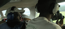
We are training as many as possible of our technicians in aerial survey methodology, so as to have a strong qualified team every year taking on the challenge of planning and carrying out the aerial surveys.
Collaboration
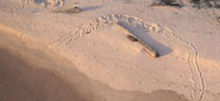
Aerial surveys help our Logs Task Force get the data it needs to plan conservation action.
Fighting Illegal Fishing from the Air:
One of the added benefits of doing aerial surveys is that it allows us a bird's-eye-view of the entire coast of Gabon.
We are thus able to take photographs and GPS coordinates of boats that are fishing too close to shore or within protected areas. We can then use this information to make reports to the Ministry of Fisheries.
Density Assessment
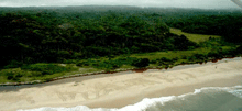
Aerial surveys help us to assess the number of turtles nesting on Gabon's beaches. In some places, we counted over 20 crawls per kilometer!
Synchronisation
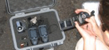
To maintain accuracy with our ground-truthing, we synchronize two GPS units with our videocameras.
Did you know?
The Cessna 206 that we use for our aerial surveys must be refueled half-way along the route. To achieve our mission, we must organise a fuel delivery to one of the remotest places in Gabon. Around here, you can't just go to the corner petrol station!