


|
|
|
|---|
| MTN | ISTS | Directory | Groups | Bookstore | Resources |
|---|
|
Satellite TrackingBasanti - Bangladesh Sea Turtle Satellite Tracking Project-Marinelife Alliance A project of Marinelife Alliance, Bangladesh. Static Map | Zoom Map | Animated Map (KB) 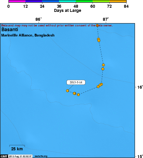 BASANTI TRACKLINE- Sea Turtle Project-Bangladesh Marinelife Alliance Background BASANTI we named a ridley turtle, 2ND tracking sea turtle in Bangladesh. Research Organization Marinelife Alliance attached SPOT5, Platform Terminal Transmitter (PTT) on her carapace on 22 FEB 2013. The night before she laid 115 eggs for season 2012-13 at Sonadia Island. BASANTI derives from the current climate season Basanto, means SPRING. We hope her safe travel and return in next winter. There are huge number of fishing gears along the coast and far offshore area. If survive, BASANTI will uncover Olive Ridley migration route those come to Bangladesh marine waters and lay eggs on sandy rookeries. Currently Olive ridley and Green sea turtle are nesting species along the coast of Bangladesh at very suitable nesting rookeries. Out of those Sonadia Island entire 11.5 kms long coast considered as prime nesting zone with two hundred fifty nests per year. It was our long term ambition to track a sea turtle in Bangladesh to uncover the fascinating migration pattern of sea turtle.
SEATURTLE.ORG collaborates with Argos to help scientists and conservationists manage and analyse their valuable animal tracking data. 
|
| About seaturtle.org | FAQ | Privacy Policy | Terms of Service |
|---|
|
Copyright © seaturtle.org All rights reserved. If you have questions or comments about seaturtle.org please contact support@seaturtle.org. If you have questions or comments about the website please contact the webmaster. |