


|
|
|
|---|
| MTN | ISTS | Directory | Groups | Bookstore | Resources |
|---|
|
Satellite Tracking57701 - Sooty Shearwaters in the California Current: 2006 A project of Pacific Procellariid Research Consortium. Static Map | Zoom Map | Animated Map (KB) 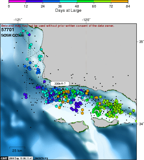 After capture on 22 June 2006, shearwater #701 has moved south from Monterey Bay to central-southern California (San Luis Bay). During the past two years, we have recorded similar exchanges among satellite-tracked shearwaters between Monterey Bay and San Luis Bay. Both coastal regions are influenced by upwelling of cool waters toward the north. The bays provide a habitat characterized by closed circulation and retention of nutrient enriched waters - ideal conditions exist here to support large standing stocks of coastal pelagic fin-fishes such as northern anchovy and Pacific sardine.
SEATURTLE.ORG collaborates with Argos to help scientists and conservationists manage and analyse their valuable animal tracking data. 
|
| About seaturtle.org | FAQ | Privacy Policy | Terms of Service |
|---|
|
Copyright © seaturtle.org All rights reserved. If you have questions or comments about seaturtle.org please contact support@seaturtle.org. If you have questions or comments about the website please contact the webmaster. |