


|
|
|
|---|
| MTN | ISTS | Directory | Groups | Bookstore | Resources |
|---|
|
Satellite Tracking5523 - Grupo Tortuguero: Pacific Sea Turtle Tracking A project of Grupo Tortuguero Tracking Project. Static Map | Zoom Map | Animated Map (KB) 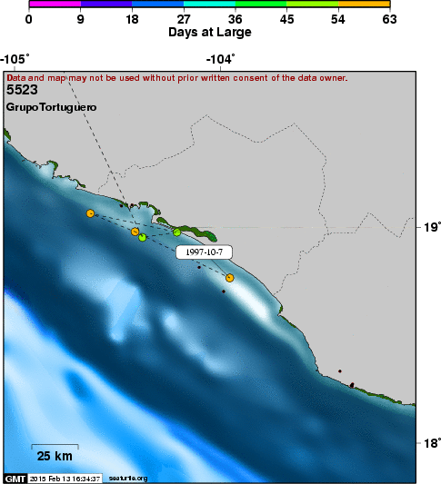
Background Xaviera is a female green turtle, named for the nearby mission San Xavier and for Javier Alvarado, our collegue in Michoacan, Mexico. This turtle remained in BahÃa de Loreto for approximately 24 days prior to beginning its homing migration to Michoacan. Location data indicate that the turtle remained in the vicinity of Playa Notri, south of Loreto, BCS, until it moved beyond the south end of Isla del Carmen. During its migration, the turtle moved directly across the mouth of the Gulf of California to the mainland shelf (< 100 fathoms) and continued southward along the coast. The turtle seems to have deviated from its coastal movements in the vicinity of Mazatlán, then regained its coastal route to the south. The turtle continued along the coast of Sinaloa, past San Blas. There are no quality location data from just north of BahÃa Banderas, Nayarit, to the vicinity of nesting beaches in Michoacan, a period of five days. We assume that the turtle crossed the mouth of the bay and continued south along the mainland coast. Data suggest that the turtle spent approximately a week along the northern Michoacan coast prior to moving approximately 5 km SE of Colola, Michoacan, near a beach known a Careysillos, a known area of green turtle copulation (Alvarado et al. 1992). Here the signal was lost, possibly due to antenna damage or transmitter loss during copulation. The turtle, identified by its flipper tags, was reported nesting in Colola, Michoacan on 21 October 1997 (Jesus Diaz Flores, pers. comm.). The straight-line distance between endpoints of the homing movement was 1,194 km with an average heading of 134.0º (SE). The straightness index of the entire track was 0.82.
SEATURTLE.ORG collaborates with Argos to help scientists and conservationists manage and analyse their valuable animal tracking data. 
|
| About seaturtle.org | FAQ | Privacy Policy | Terms of Service |
|---|
|
Copyright © seaturtle.org All rights reserved. If you have questions or comments about seaturtle.org please contact support@seaturtle.org. If you have questions or comments about the website please contact the webmaster. |