


|
|
|
|---|
| MTN | ISTS | Directory | Groups | Bookstore | Resources |
|---|
|
Satellite TrackingCoco - Distribution of green sea turtles in the South Atlantic Bight A project of SCDNR/MRD/MRRI. Static Map | Zoom Map | Animated Map (KB) 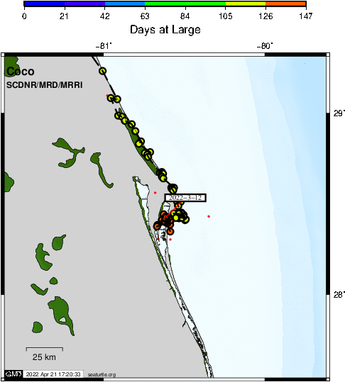
Background "Coco" is a juvenile (37.4cm SCLmin, 6.5kg) green sea turtle that stranded on Jekyll Island, GA with a fractured skull and carapace from a boat strike on 16 July 2020. âCocoâ was transported to the Georgia Sea Turtle Center on Jekyll Island for emergency care and rehabilitation. Unrelated to stranding, âCocoâ was also missing a rear flipper. The skull fracture was repaired under general anesthesia using Steristrips and tissue glue and Rediheal and tissue glue. The carapace fracture was stabilized with screws and wires. Rediheal and tissue glue and Wound VAC therapy were used during the course of healing. Total parenteral nutrition or TPN (intravenous nutrition) was used to maintain âCoco'sâ weight and strength. After several months of not eating and associated anemia, "Coco" finally turned the corner. Following a year and three months of rehabilitation, "Coco" was released off Jekyll Island 19 October 2021. We are excited to follow "Coco" using a satellite transmitter to get a better idea of the seasonal whereabouts of this very fortunate sea turtle!
SEATURTLE.ORG collaborates with Argos to help scientists and conservationists manage and analyse their valuable animal tracking data. 
|
| About seaturtle.org | FAQ | Privacy Policy | Terms of Service |
|---|
|
Copyright © seaturtle.org All rights reserved. If you have questions or comments about seaturtle.org please contact support@seaturtle.org. If you have questions or comments about the website please contact the webmaster. |