


|
|
|
|---|
| MTN | ISTS | Directory | Groups | Bookstore | Resources |
|---|
|
Satellite TrackingRaine - Distribution of green sea turtles in the South Atlantic Bight A project of SCDNR/MRD/MRRI. Static Map | Zoom Map | Animated Map (KB) 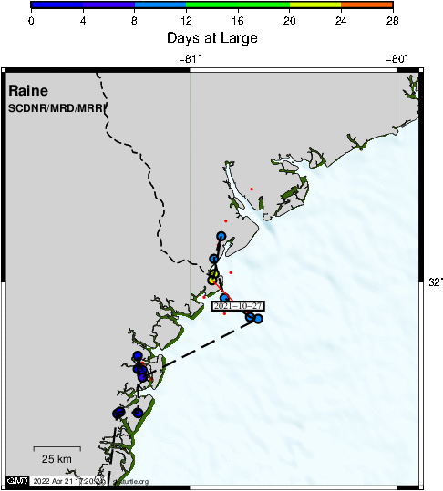
Background âRaineâ is a juvenile (40.9cm SCLnt, 9.1kg) green sea turtle that stranded on St. Andrews Beach (Jekyll Island, GA) on 1 July 2021 and was brought to the Georgia Sea Turtle Center for rehabilitation. "Raine" presented with an entanglement around left front flipper and neck and a boat strike injury on the right carapace. The boat strike fracture was repaired with screws and wires and wound care. The line wraps were treated with honey and other topical medications. Supportive care and antibiotic therapy were used initially until the turtle was more stable and eating independently. Very mild fibropapilloma tumors were found on initial exam and developed further while in captivity. The tumors were successfully removed via CO2 laser. After making a successful recovery from the injuries, "Raine" was released off Jekyll Island 4 October 2021.
SEATURTLE.ORG collaborates with Argos to help scientists and conservationists manage and analyse their valuable animal tracking data. 
|
| About seaturtle.org | FAQ | Privacy Policy | Terms of Service |
|---|
|
Copyright © seaturtle.org All rights reserved. If you have questions or comments about seaturtle.org please contact support@seaturtle.org. If you have questions or comments about the website please contact the webmaster. |