5524 - Grupo Tortuguero: Pacific Sea Turtle Tracking
A project of Grupo Tortuguero Tracking Project.
Static Map | Zoom Map |
 |
 |


|
|---|
| MTN | ISTS | Directory | Groups | Bookstore | Resources |
|---|
|
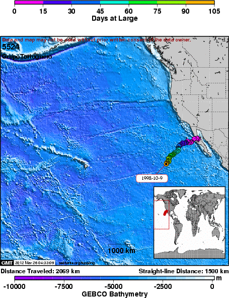
Satellite Tracking5524 - Grupo Tortuguero: Pacific Sea Turtle Tracking A project of Grupo Tortuguero Tracking Project. Static Map | Zoom Map | Background This juvenile loggerhead was the first sea turtle of the 1998 project. Lupita was a 158 lb. loggerhead that was released with a satellite transmitter near Santa Rosaliita, Baja Californina, Mexico. She is the first of three turtles begin tracking this summer. This turtle is truly in the ocean wilderness and probably encounters only the rare fishing boat. Still, the nets and hooks of tuna and shark fishermen are a threat as we have seen in the past.
SEATURTLE.ORG collaborates with Argos to help scientists and conservationists manage and analyse their valuable animal tracking data. 
|
| About seaturtle.org | FAQ | Privacy Policy | Terms of Service |
|---|
|
Copyright © seaturtle.org All rights reserved. If you have questions or comments about seaturtle.org please contact support@seaturtle.org. If you have questions or comments about the website please contact the webmaster. |