


|
|
|
|---|
| MTN | ISTS | Directory | Groups | Bookstore | Resources |
|---|
|
Satellite TrackingVincenzo - Canary Islands - OAG A project of Observatorio Ambiental Granadilla. Static Map | Zoom Map | Animated Map (KB) 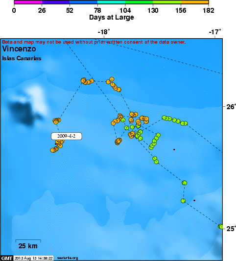
Background Vincenzo was entangled when she was captured in the south of Gran Ganaria Island by the crew of the whale-watching boat Spirit of the Sea. Later she was moved to the Wildlife Rehabilitation Center of Gran Canaria. The entanglement was light and the medical tests showed she was in good health. She was tagged with a transmitter and then she was 43.5 cm of curve carapace length.
SEATURTLE.ORG collaborates with Argos to help scientists and conservationists manage and analyse their valuable animal tracking data. 
|
| About seaturtle.org | FAQ | Privacy Policy | Terms of Service |
|---|
|
Copyright © seaturtle.org All rights reserved. If you have questions or comments about seaturtle.org please contact support@seaturtle.org. If you have questions or comments about the website please contact the webmaster. |